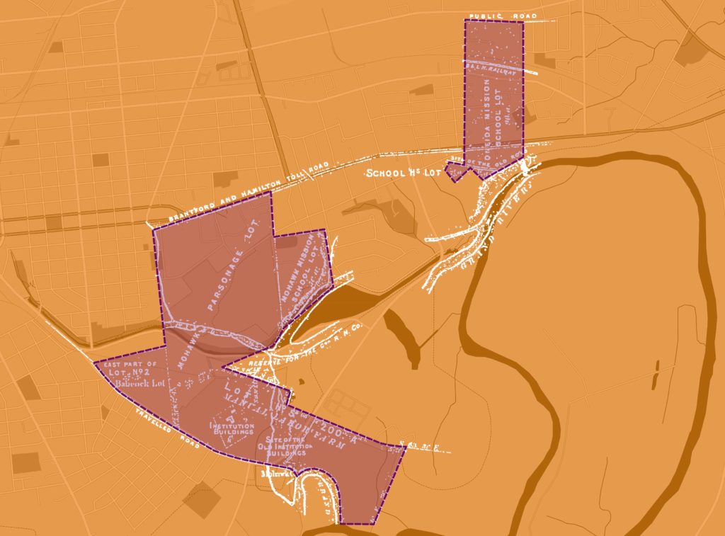
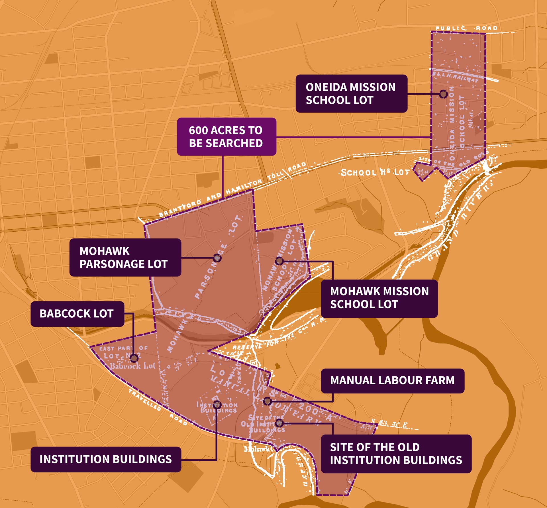
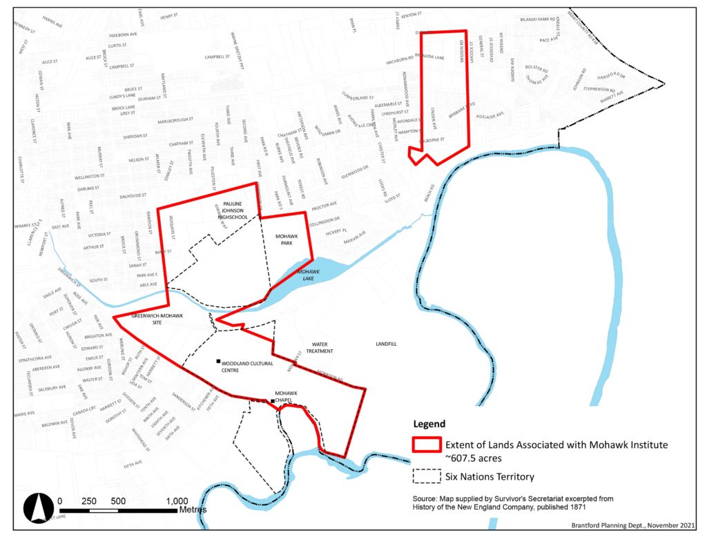
The Survivors’ Secretariat is using maps, documents, and records to determine the search strategy for over 600 acres of land associated with the Mohawk Institute
Click map to enlarge.
Please note that this map is a combination of old and new data using both historical records and 2022 mapping. It does not represent a legal land survey.
Currently, Six Nations and the Survivors’ Secretariat are working with the City of Brantford to update official maps. In addition, the City has agreed to alert us to any development that will occur on lands associated with the former Mohawk Institute.
The Survivors’ Secretariat is using archival and modern-day maps, records, and documents to outline the grounds associated with the Mohawk Institute that may be searched. These include the Mohawk Parsonage Lot, Mohawk Mission School Lot, the Manual Labour Farm and the Mohawk Chapel Grounds— totalling over 600 acres. As this map shows, some of the areas are now parks and industrial areas in Brantford, Ontario.
Understanding the Maps & Records
According to archival records from the National Centre for Truth and Reconciliation: “In 1885, the IRS (Indian Residential School) was situated on 9.93 acres of land on “Lot Five” of the Eagle’s Nest Tract in Brantford, Ontario. The IRS land was surrounded by the Six Nations Indian Reserve No. 40, and it became part of the reserve upon the closure of the IRS. The IRS also used the Babcock Lot, the Mohawk Farm (Manual Labour Farm), and the Mohawk Parsonage (Glebe Lot).”
The records that are housed with the National Centre for Truth and Reconciliation have been important in determining the grounds included in the potential search area.
- The 20-acre Babcock Lot comprised the east portion of Lot Two, Eagle’s Nest Tract.
- The Manual Labour Farm comprised approximately 200 acres on the whole of Lot Five, Eagle’s Nest Tract, and was held under License of Occupation granted to the New England Company in 1859.
- The 220-acre Mohawk Parsonage (Glebe Lot) was located to the north of the Manual Labour Farm.
- The size of the Mohawk Parsonage lot used by the IRS was described as 200 acres in 1898; 186 acres in 1901; and 176 acres in 1908.
Important conversations with Survivors and community will occur to determine what areas of the former Mohawk Institute lands may be searched and when.