Survivors are utilizing technology to help fulfill their mandate of uncovering and sharing the truth about what happened at the Mohawk Institute.
Q: How and Why Are Survivors Searching for Missing Children?
- The Truth and Reconciliation Commission documented the names of 48 children that died while being forced to attend the Mohawk Institute. We don’t know where they are buried, or if other children died during the Institute’s 136 years of operation. Survivors have stated that children “just disappeared” and that they don’t know if something bad happened to them or if they returned safely to their homes.
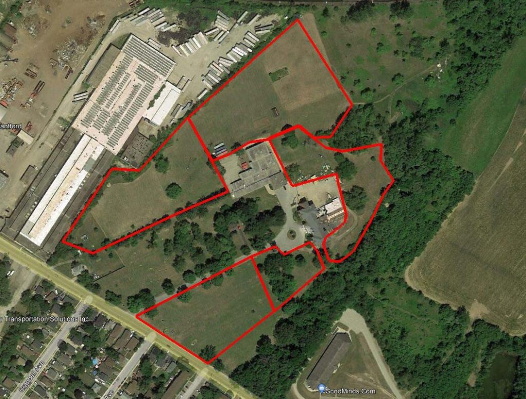
- The Survivors’ Secretariat is using archival and modern-day maps, records, and documents to outline the grounds associated with the Mohawk Institute that may be searched. These include the Mohawk Parsonage Lot, the Mohawk Mission School Lot, the Manual Labour Farm and the Mohawk Chapel Grounds— totaling over 600 acres. ¹
- In addition, the Survivors’ Secretariat is among the first communities to use Light Detection and Ranging (LiDAR) equipment in the search for unmarked burials.
- Survivors are also utilizing Ground-Penetrating Radar (GPR) to assist in answering their question of “how many children died and where are they buried?”
This article outlines how these technologies work as well as their advantages and limitations.
Q: What is LiDAR?
There are different types of LiDAR:
- LiDAR mapping uses laser light pulses to generate three dimensional (3D) maps of the earth’s surface. These instruments can collect information from piloted and unpiloted aircraft, or from tripod-mounted devices on the ground. The Survivors’ Secretariat is using both aerial and terrestrial (ground) LiDAR.
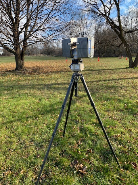
- The Survivors’ Secretariat is using LiDAR to produce detailed maps of the ground surface. These maps record subtle changes in the ground to find disturbances caused by humans.
- LiDAR maps may reveal evidence of old service trenches, drainage ditches, trash pits, building rubble, or shallow depressions left by grave shafts. The size, orientation and distribution of such features, coupled with old air photographs and maps, will help reconstruct earlier versions of the Mohawk Institute and its outbuildings.

Q: What is Ground-Penetrating Radar?
- Ground-Penetrating Radar (GPR) has become a widely used tool for locating unmarked burials at former residential school sites.”
- GPR is similar to medical ultrasound but instead, high-frequency radio waves are sent into the ground to document the distribution of features underground. Some of these features might be natural such as roots, rocks, insects, etc. while others may be caused by human activity such as burials.
- The GPR machine looks like a small box on wheels attached to a handle and electronic screen that contains a data logger and output. The wheeled box is pushed along an organized grid by a technician. The box contains a radar system that sends pulses into the ground as well as a receiver that collects its data. The timed interval between pulses – leaving the box until its return – allows an estimation of the depth of whatever caused it to reflect back to the surface.
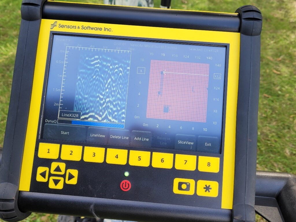
- These reflections can be difficult to interpret because they might reflect natural sediment conditions or be affected by soil texture and moisture conditions as well as roots and other natural features. The reflections might also be due to rock, metal, and other materials mixed in the soil, resulting in signal ‘noise’ that obscures the features being searched for. Careful analysis by skilled technicians is required to ‘filter’ the data and identify ‘reflections’ that might indicate burials.
- This video about Archaeological Remote Sensing (or ground-penetrating radar) created by the Canadian Archaeological Association (CAA) and the Institute for Prairie and Indigenous Archaeology (IPIA) at the University of Alberta, describes GPR and some of its limitations.
- The CAA writes: “The truth is with ground-penetrating radar, we can never be 100% certain that what we’re seeing is in fact a grave, but there are well established methods that have been used by archaeologists for many, many years that can help us build our confidence that what we’re actually seeing is a grave.”²
Q: How Are Survivors Using These Technologies?
- Community members and Six Nations Police Service’s members on the Task Force have been trained in the use of the ground-penetrating radar equipment and are the primary searchers. Survivors are directing which areas should be searched and in what order.
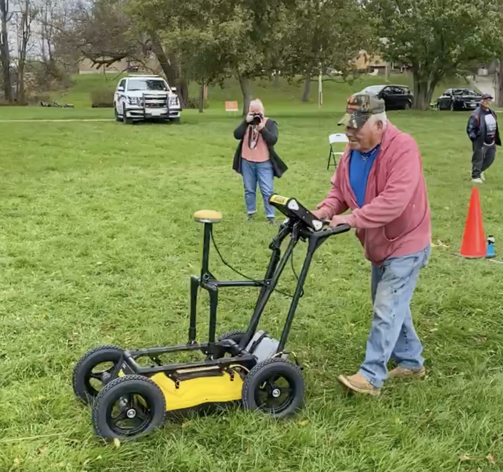
- In the fall of 2021, 60 10’x10’ grids were laid out to be GPR scanned. Searchers were able to scan 37 of these grids before the snow covered the grounds. The remaining 23 grids will be completed in early spring and new grids will be laid out.
- In December 2021, the Secretariat scanned 10 acres with LiDAR technology. The data from these scans are now being processed and analyzed.
Q: What are the Limitations of LiDAR and GPR?
- It’s important to note that while GPR data can provide information about soil being disturbed, it is not like an X-ray; it does not illustrate bodies or bones.³
- While equipment and technologies are critical to the search of the land surrounding the former Mohawk Institute and the possible identification of unmarked burials, a 100% success rate is not guaranteed.
- There are several important factors affecting the success of these technologies, including: geography, soil conditions, training of users, and the overall operation and success of receiving data from these devices.
Moving Forward
The powerful combination of Survivors’ testimonies, archival records and current technologies allows the Survivors’ Secretariat to further its mandate to uncover and share the truth. Despite the complexities involved in the search of the former Mohawk Institute, Survivors and community members continue to innovate and strategize as they move forward with this Sacred work of finding the missing children.